Thanks to Arlen, Shannon, and Jason for the writeups on the past couple weeks’ progress!
From 8/30:
Following up on clues provided by Scott and Julia’s nifty detective work, last Friday four of us deployed on a casualty recovery mission to the borrow pit pond behind Roger’s Gardens at 42nd St. and Hwy 126, where they had detected 4 radio tags the previous week. Around 11am we launched our pair of sturdy and roomy craft, with Scott and Julia taking the lead with the receiver, while Shannon and I stayed close by to help with the recovery.
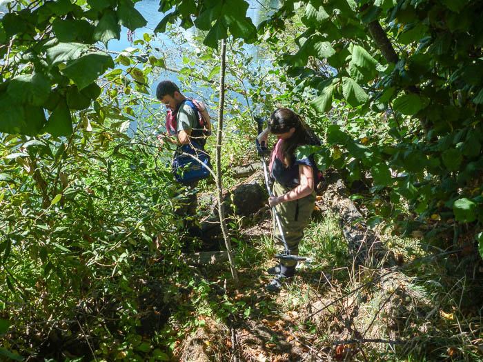
We tracked tag #9 along the shoreline, and determined that the signal was strongest up the bank a ways. So while Shannon schmoozed with the nearby residents (making sure they didn’t shoot the trespassers), we remaining three dove into the shore-side underbrush; radio reciever + antenna, large magnets and metal detector in hand.
This is the kind of ground we were picking through, only with the tag half-buried and much better hidden than in this re-enactment photo:
Other radio signals seemed to be emanating from the water just offshore, and we spent quite a long time in this spot, with Scott up to his neck in water as he dug around in the bottom muck feeling for tags, all the while slowly disappearing into the ooze himself.
Rather than spoil the suspense, I’ll wait for Scott, Julia and Shannon to weigh in with their additions to the story and the final results of our sojourn. I will just say that the reported 100-200 cormorants that over-winter at this pond have been very busy.
Arlen
8/30 Continued:
Ahhh… where were we? Was Shannon schmoozing with the adjacent landowners whilst Arlen, Scott and Julia flailed the undergrowth?? Or was Scott already up to his armpits in oozing muck?
In any case, the result of slogging through the blackberry and downed cottonwood with was the retrieval of Tag 9 (Gil). He had been released at mile 20 (which may be an important piece of info later, but maybe not). Following a brief celebration, Julia and Scott went back to work with the receiver, having picked up tag 21 (Ole) somewhere close in the vicinity. In fact, Ole’s tag pinged strongest about 12 feet away from Gil’s, but in the water.
A variety of methods were employed in the search for tag 21 ranging from flinging piles of muck up onto the bank to the near-sacrifice of a sandal to the pond sediment gods. But Ole’s tag was not going to go easily; it alternately gave a strong signal, a weak signal and no signal, all with the antenna cord held in the same location. Finally, Ole’s tag gave a few strong chirps, coding out very high with a low gain, and we thought we were close. Scott dragged the magnet through and… tag 21 (Harvey) started giving a very strong signal from the exact same location. This was at precisely 1:00 PM. Stunned silence gave way to laughter and Scott gamely started digging around in the muck one more time. He pulled a handful of twigs and muck and both Julia and Shannon started squealing at the sight of metal in his hand. Alas, it was just the end of the antenna cord. And back down he dove.
Eventually, Scott got the magnet close enough to Harvey’s tag that he turned it off, and then was able to retrieve it. Harvey had been released at mile 20. Scott spent another 15-20 minutes trying to unearth Ole’s tag but as the time approached 2:00, we decided to cut our losses. We were certain that Ole’s tag was buried in the muck, but conjectured that it was either missing the antenna, somewhat on the fritz, or just buried so deeply in the muck that the signal was distorted. Regardless, the disposition of Ole, who was released at mile 20, is now certain.
Scott and Julia had coded tag 12 (Rusty) around the same area, so after pulling Scott out of the bottom of the pond, we all piled back into the boats and paddled around the perimeter with the reciever. We did not pick up Rusty’s tag again, and so hypothesized that when Scott and Julia coded it, the tag was likely on the wing. Rusty had been released at mile 19.6 and is presumed to be deceased.
We took the boats our and packed up our gear. A very sincere thanks to Jean, the landowner, for allowing us to access the pond. She even let us drive through her back yard to get a bit closer to the one break in the blackberries to launch the boats.
These are the facts to the best of my recollection. The interpretation of them is almost limitless, but a few points/questions that stand out to me follow:
We have confirmed that 6 of our tagged fish are deceased. Several more are presumed dead. While we don’t know the ambient mortality rate for rainbow trout in the study reach, it seems likely to me that a greater-than 25% mortality rate in fish 10”+ is elevated above natural levels.
- We are assuming that because these fish have been found under “fowl” circumstances, the mortality was caused by the predation. We don’t know, however, if the birds actually killed them or if the fish were dead when the birds picked them up.
- It would feel irresponsible to me to put these tags into new fish, given the questions that we have about how the tags are potentially affecting the fish. Likewise, as we start to discuss a next stage of a radio tag project, we will need to take these things into consideration.
- Several of the deceased fish were released at mile 20.0. This may be a little artificial, since mile 20.0 is the boat ramp at Gossler’s, and a lot of fish were tagged and released there because it was a very handy location. However, of the 10 fish that were tagged and released there, 4 of them are dead. To be fair, I did look at who tagged the mortalities, but they were pretty evenly split.
Anyway, lots to think about through the winter. I am curious to see what this week’s tracking turns up. Thanks to Jason and Bill for stepping up to track.
Shannon
9/7
Fish were pretty much in the same positions except 13 didn’t show up at all. I also got one ping for a tag number 1. ??? The machine volume low as I entered the braids so I missed the exact location for 16 and 17. But they both pinged above the braids. So 17 definitely moved up from below the power line run which holds lots of fish (Bellinger-Hayden section). Interesting because two weeks ago it was in the exact same location as it was back in April or May.
Best,
Jason